
A week long skiing trip in the north where Finland, Sweden and Norway meet at the end of March.
Ten years ago I went on a little trip in the Pältsa area with a fatbike at the end of July. Despite mostly miserable weather, a horrible amount of bugs and a Campylobacter infection, which had me in the bed for five days with 40°C fever and bloody diarrhea when I got home, I took a liking to the place. When asked about a skiing trip with some kayaking buddies, K and E, I was immediately in, especially since the winter in Turku is never guaranteed to be acceptable, and nothing was known of it when the train tickets (car to Kolari) was reserved in the fall. As it turned out, the winter in the Turku region was unusually good, and combined with quite a bit of work stress before my winter vacation, I for a moment wasn't too keen on it, a feeling I did know would pass immediately after actually starting the trip.
On Thursday evening we drove to Pasila, loaded the car on the train, and got out at Kolari on Friday morning. With less than 300 km to drive, we were in no real hurry.

We arrived at Kilpisjärvi, packed the stuff and started to ski southwards a little over five in the afternoon. The weather was wintry, and the rain in the area a few days earlier could be noticed only though a crust layer under the new snow.


The skiing was uneventful and a little before eight in the evening we arrived at the open cabin at Kuohkimajärvi, which turned out to be empty. We put some wood into the stove, made dinner and fairly quickly went to sleep, since the previous night had seen less sleep due to a much too hot sleeper cabin on the train.
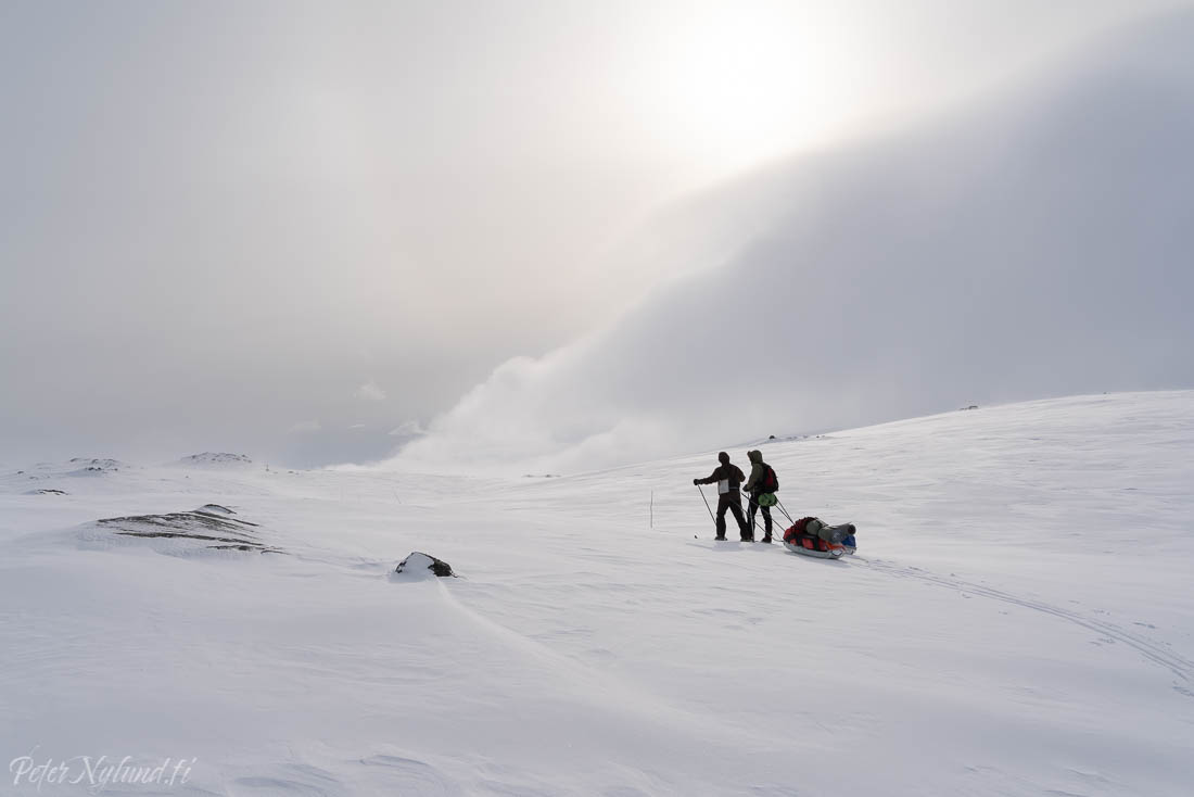
For a moment, the weather looked promising the next morning.

By the time we got going, though, the wind increased and it snowed, so I decided to go with a full shell layer, something I rarely do. I'm much too warm to be comfortable in Gore-Tex style clothes.


Now we had fairly nice skiing without any mentionable ups and downs.


The contour interval on the 1:100000 map was 20 m, which meant that some things got unnoticed. We were high enough that most creeks didn't run deep in the landscape, but there were some surprises.


The orienteering was quite easy in the nice weather.


Entering Isdalen.


When we got into Isdalen we got a strong headwind. No real shelter from the wind was to be found, so the lunch was a rather quick.

After the lunch we had one more climb to go, after which we would go down over 500 m in altitude. This part was again marked with tree sticks, probably since the safe route wasn't very obvious from the terrain or map.


The next morning looked nice.


Heia Norge!

The weather was splendid and we got going at around nine in the morning.

Occasionally the snow was blown hard, occasionally even icy, but for the most part there was new snow on top of a crust that made going very much possible, but still quite slow.


The entire day would be spent going slightly uphills.

A dog sled group.


The small hut at Moskánjávri.


Pältsan.


A view back to the valley where the Kummaeno river starts.

After finally getting up on the plateau there were less going up and down.


Lunch break with at least some shelter from the wind. Picture by E.


Going down outside an established route is always a bit fun. The map shown only the steepest parts and largest gorges and you could easily encounter 10 meter drops not visible on the map. In addition, the birch forest might have deep soft snow. This time the snow was solid and great to ski on and we found a pretty much optimal route down to the lake.

We got down to the lake, and skied to Goldahytta, even though there seemed to be quite a bit of activity there. It turned out that the cabin was quite occupied with around 22 Norwegian high school students and their three teachers. They had been stuck there an extra day because of some sickness. Needless to say, we quickly reconsidered staying there and instead turned towards Kuohkimajärvi. On the way there we met more Norwegians, this time a middle school class of again a total of around 25 persons. We chatted a bit with one of the teachers, who spoke a thick north Norwegian dialect that I had a bit trouble understanding. They were also going Goldahytta, though the high school class was supposed to have moved to Gappohytta by then. That didn't happen, so there was probably quite a circus at Goldahytta that night. I must say that I do admire the Norwegian approach (ut på tur aldri sur), though. The students skied in their own tempo, spread over maybe 10 km with four teachers. That would never happen in Finland.

The next and final morning was nice.


Saana, the fell above Kilpisjärvi.


At one point some dense snowfall came in and cut the visibility, but eventually some of the visibility returned.


Then we skied down, which went very much faster than the climb up. After that, sauna, pizza, beer and a good night's sleep before making the journey home on Friday and Saturday.
No comments:
Post a Comment